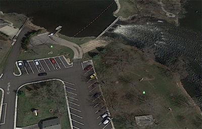
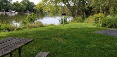
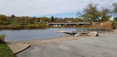
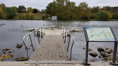
186.9. Mitchell Park-North Canoe Access
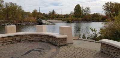
186.1. Mitchell Park-South Canoe Access
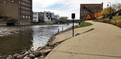
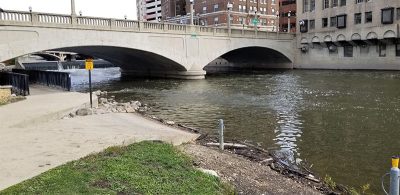
177.8. Frame Park
176.4. Fox River Sanctuary
173.5. Fox River Parkway North
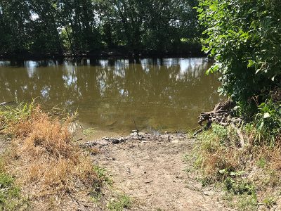
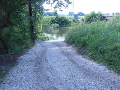
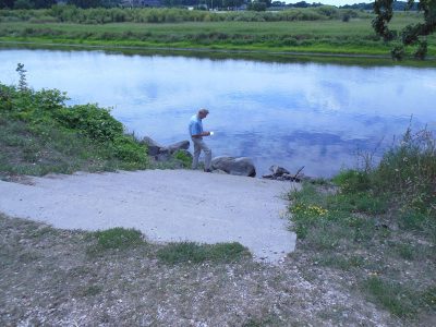
171.9. Fox River Park (Temporarily Closed)
166.9. CTH I Access Site
165.8. Vernon Marsh (North)
161.4. Vernon Marsh (South)
160.5. CTH ES Access Site
155.5. Center Drive Access Site
153.1. Big Bend Riverside Park
151.8. Fox River Greenway
146.5. Tichigan Lake Public Access
141.7. Huening Park
141.5. Village Hall Park
141.5. River Bend Park
141.4. 10 Club Park (Temporarily Closed)
139.7. Pioneer Memorial Park
139.4. Case Eagle Park North
139.3. Case Eagle Park South
138.1. Saller Woods
136.2. CTH W Access Site
133.7. Riverside Park
133.3. Wehmhoff-Jucker Park
132.6. Bushnell Park
132.4. St. Mary's Park
127.8. Hoosier Creek Road Access Site
127.2. CTH JB Access
124.3. 328th Avenue / CTH W
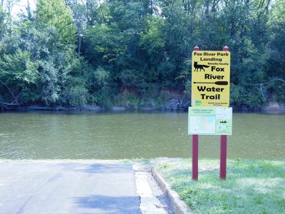
118.6. Fox River Park Access
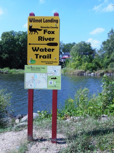
116.1. Wilmot Access (CTH C)
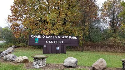
113.5. Oak Point in Chain O' Lakes SP
110.6. Maple Grove Launch in Chain O'Lakes SP
100.7. Miller Point
99.4. Miller's Riverfront Park and Boat Launch
98.2. Moraine Hills State Park (above dam)
98.1. Moraine Hills State Park (below dam)
92.3. Hickory Grove Riverfront
91.2. Fox River Forest Preserve
186.1. Mitchell Park-South Canoe Access
177.8. Frame Park
176.4. Fox River Sanctuary
173.5. Fox River Parkway North
171.9. Fox River Park (Temporarily Closed)
166.9. CTH I Access Site
165.8. Vernon Marsh (North)
161.4. Vernon Marsh (South)
160.5. CTH ES Access Site
155.5. Center Drive Access Site
153.1. Big Bend Riverside Park
151.8. Fox River Greenway
146.5. Tichigan Lake Public Access
141.7. Huening Park
141.5. Village Hall Park
141.5. River Bend Park
141.4. 10 Club Park (Temporarily Closed)
139.7. Pioneer Memorial Park
139.4. Case Eagle Park North
139.3. Case Eagle Park South
138.1. Saller Woods
136.2. CTH W Access Site
133.7. Riverside Park
133.3. Wehmhoff-Jucker Park
132.6. Bushnell Park
132.4. St. Mary's Park
127.8. Hoosier Creek Road Access Site
127.2. CTH JB Access
124.3. 328th Avenue / CTH W
118.6. Fox River Park Access
116.1. Wilmot Access (CTH C)
113.5. Oak Point in Chain O' Lakes SP
110.6. Maple Grove Launch in Chain O'Lakes SP
100.7. Miller Point
99.4. Miller's Riverfront Park and Boat Launch
98.2. Moraine Hills State Park (above dam)
98.1. Moraine Hills State Park (below dam)
92.3. Hickory Grove Riverfront
91.2. Fox River Forest Preserve
84.4. Fox Bluff Conservation Area
82.1. Riverfront Park
81.8. Cornish Park (below dam)
80.6. Buffalo Park Forest Preserve
78.3. Fox River Shores Forest Preserve
76.7. McNamee Park
75.9. Downtown West Dundee
75.2. South End Park
73.6. Voyageur Landing Forest Preserve (North)
73.5. Voyageur Landing Forest Preserve (South)
73.3. Trout Park
72.1. Slade Avenue Park
71.4. Veterans Memorial Park
71.1. Kimball Street Dam
69.3. Elgin Shores Forest Preserve
65.4. Jon J. Duerr Forest Preserve
61. Ferson Creek Park
60.5. Boy Scout Island
60.4. Pottawatomie Park
60.2. Frank Gorham Memorial Canoe Launch
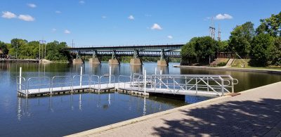
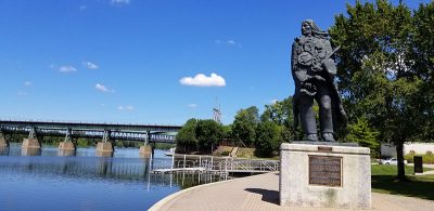
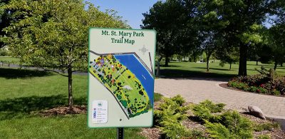
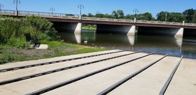
59.5. Mt. St. Mary Park
58.3. Geneva Boat Launch
56.5. Fabyan Forest Preserve
55.9. Laurelwood Park
55.7. Batavia Dam (above dam)
55.6. Batavia Dam (below dam)
55.5. Batavia Riverwalk Ramp
49.3. Veterans Memorial Island Park
48.4. Aurora (West)
47.1. South River Street Park
43.9. Violet Patch Park
42.7. Hudson Crossing Park
40.4. Saw-Wee-Kee Park
36.3. Marge Cline Whitewater Course
31.7. Silver Springs State Park
28.9. Shuh Shuh Gah Forest Preserve
24.8. Lois Landing
5.7. Dayton Dam (above dam)
5.4. Dayton Dam (below dam)
0.8. Fox River Park
82.1. Riverfront Park
81.8. Cornish Park (below dam)
80.6. Buffalo Park Forest Preserve
78.3. Fox River Shores Forest Preserve
76.7. McNamee Park
75.9. Downtown West Dundee
75.2. South End Park
73.6. Voyageur Landing Forest Preserve (North)
73.5. Voyageur Landing Forest Preserve (South)
73.3. Trout Park
72.1. Slade Avenue Park
71.4. Veterans Memorial Park
71.1. Kimball Street Dam
69.3. Elgin Shores Forest Preserve
65.4. Jon J. Duerr Forest Preserve
61. Ferson Creek Park
60.5. Boy Scout Island
60.4. Pottawatomie Park
60.2. Frank Gorham Memorial Canoe Launch
59.5. Mt. St. Mary Park
58.3. Geneva Boat Launch
56.5. Fabyan Forest Preserve
55.9. Laurelwood Park
55.7. Batavia Dam (above dam)
55.6. Batavia Dam (below dam)
55.5. Batavia Riverwalk Ramp
49.3. Veterans Memorial Island Park
48.4. Aurora (West)
47.1. South River Street Park
43.9. Violet Patch Park
42.7. Hudson Crossing Park
40.4. Saw-Wee-Kee Park
36.3. Marge Cline Whitewater Course
31.7. Silver Springs State Park
28.9. Shuh Shuh Gah Forest Preserve
24.8. Lois Landing
5.7. Dayton Dam (above dam)
5.4. Dayton Dam (below dam)
0.8. Fox River Park
Access Point Key
Carry-in access
Developed access
Carry-in seasonal
Accessible seasonal dock
Designated parking

Fee
Restrooms
Picnic area
Drinking water
Shelter
Designated camping area
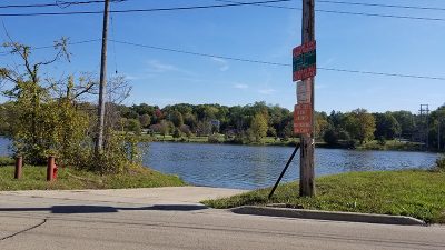
186.9. Mitchell Park-North Canoe Access
Brookfield, Waukesha County
River mile 186.92 East bank, 43.0856° -88.1602°
View on map | Get directions |
Back to topRiver mile 186.92 East bank, 43.0856° -88.1602°
Access type: Carry-In
Fee? No
Signs: Water, Land
Vehicle Access: Parking Lot
Owner: City
Amenities: Restroom, Drinking Water, Shelter, Picnicking, Playground, Hiking, Biking, Bird Watching, Natural Area, Concert Events
Notes: Restroom, drinking water, and shelter across street from launch
186.1. Mitchell Park-South Canoe Access
Brookfield, Waukesha County
River mile 186.14 East bank, 43.078° -88.1616°
View on map | Get directions |
Back to topRiver mile 186.14 East bank, 43.078° -88.1616°
Access type: Carry-In
Fee? No
Signs: Water, Land
Vehicle Access: Parking Lot
Owner: City
Amenities: Restroom, Drinking Water, Shelter, Picnicking, Playground, Hiking, Biking, Bird Watching, Natural Area, Concert Events
Notes: May likely need to portage over boardwalk located south of launch
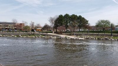
177.8. Frame Park
Waukesha, Waukesha County
River mile 177.84 East bank, 43.0182° -88.2242°
View on map | Get directions |
Back to topRiver mile 177.84 East bank, 43.0182° -88.2242°
Access type: Developed
Fee? No
Signs: Water, Land
Vehicle Access: Parking Lot
Owner: City
Amenities: Restroom, Shelter, Picnicking, Playground, Swimming, Fishing, Hiking, Biking, Onsite Boat Rental, Concert Events
Notes: Launch via piers along shoreline or a paved ramp at south end of park. Seasonal watercraft rental in middle of park.
176.4. Fox River Sanctuary
Waukesha, Waukesha County
River mile 176.37 East bank, 43.0047° -88.245°
View on map | Get directions |
Back to topRiver mile 176.37 East bank, 43.0047° -88.245°
Access type: Carry-In
Fee? No
Signs: Water, Land
Vehicle Access: Parking Lot
Owner:
Amenities: Restroom, Drinking Water, Shelter, Picnicking
Notes:
173.5. Fox River Parkway North
Waukesha, Waukesha County
River mile 173.46 East bank, 42.9777° -88.2646°
View on map | Get directions |
Back to topRiver mile 173.46 East bank, 42.9777° -88.2646°
Access type: Carry-In
Fee? No
Signs: Water, Land
Vehicle Access: Parking Lot
Owner: City
Amenities: Biking
Notes: Designated canoe launch area, gravel walkway;north side of STH 59
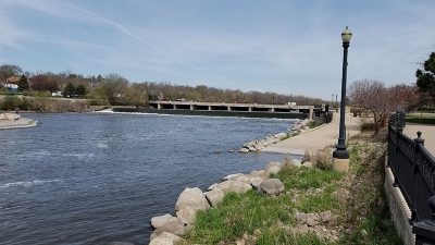
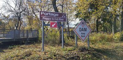
171.9. Fox River Park (Temporarily Closed)
Waukesha, Waukesha County
River mile 171.92 East bank, 42.9634° -88.2747°
View on map | Get directions |
Back to topRiver mile 171.92 East bank, 42.9634° -88.2747°
Access type: Developed
Fee? Yes
Signs: Water, Land
Vehicle Access: Parking Lot
Owner: County
Amenities: Restroom, Drinking Water, Picnicking, Hiking, Biking, Bird Watching, Natural Area
Notes: TEMPORARILY CLOSED FOR IMPROVEMENTS. This site will be closed in 2023 due to construction. Paved walkway to river
166.9. CTH I Access Site
Waukesha, Waukesha County
River mile 166.94 West bank, 42.9337° -88.2929°
View on map | Get directions |
Back to topRiver mile 166.94 West bank, 42.9337° -88.2929°
Access type: Carry-In
Fee? No
Signs: Water, Land
Vehicle Access: Roadside Parking
Owner: County ROW
Amenities: Bird Watching, Natural Area
Notes: North side of Vernon Marsh, steep roadside slopes
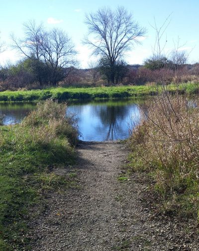
165.8. Vernon Marsh (North)
Mukwonago, Waukesha County
River mile 165.79 East bank, 42.9188° -88.2778°
View on map | Get directions |
Back to topRiver mile 165.79 East bank, 42.9188° -88.2778°
Access type: Carry-In
Fee? No
Signs: Water, Land
Vehicle Access: Parking Lot
Owner: State
Amenities: Hiking, Bird Watching, Natural Area
Notes: one-quarter mile walk on a service road to river from parking lot
161.4. Vernon Marsh (South)
Mukwonago, Waukesha County
River mile 161.42 West bank, 42.8989° -88.3208°
View on map | Get directions |
Back to topRiver mile 161.42 West bank, 42.8989° -88.3208°
Access type: Carry-In
Fee? No
Signs: Water, Land
Vehicle Access: Parking Lot
Owner: State
Amenities: Hiking, Bird Watching, Natural Area
Notes: Approximately 1 mile walk from CTH NN parking lot and Frog Alley parking lot, short paddle east to river
160.5. CTH ES Access Site
Mukwonago, Waukesha County
River mile 160.5 East bank, 42.8759° -88.306°
View on map | Get directions |
Back to topRiver mile 160.5 East bank, 42.8759° -88.306°
Access type: Carry-In
Fee? No
Signs: Water, Land
Vehicle Access: Roadside Parking
Owner: County ROW
Amenities: none
Notes: Parking area along National Ave (CTH ES)
155.5. Center Drive Access Site
Big Bend, Waukesha County
River mile 155.53 West bank, 42.8768° -88.2481°
View on map | Get directions |
Back to topRiver mile 155.53 West bank, 42.8768° -88.2481°
Access type: Carry-In
Fee? No
Signs: Water, Land
Vehicle Access: Roadside Parking
Owner: Town ROW
Amenities: none
Notes: Gradually-sloped gravel launch site
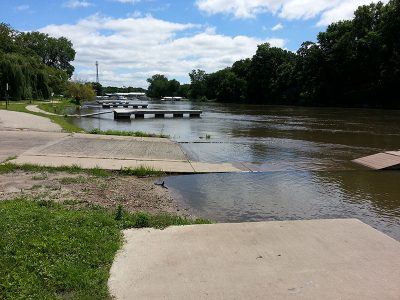
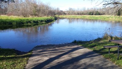
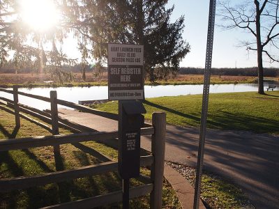
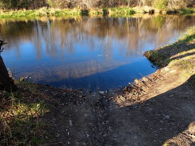
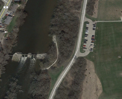
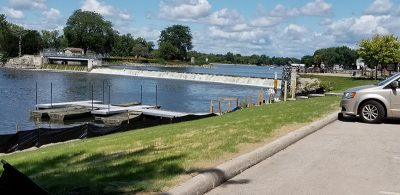
153.1. Big Bend Riverside Park
Big Bend, Waukesha County
River mile 153.11 East bank, 42.877° -88.2113°
View on map | Get directions |
Back to topRiver mile 153.11 East bank, 42.877° -88.2113°
Access type: Developed
Fee? Yes
Signs: Water, Land
Vehicle Access: Parking Lot
Owner: Village
Amenities: Restroom, Shelter, Camping, Picnicking, Playground, Fishing
Notes: Paved launch
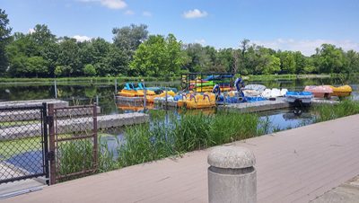
151.8. Fox River Greenway
Big Bend, Waukesha County
River mile 151.8 East bank, 42.863° -88.1981°
View on map | Get directions |
Back to topRiver mile 151.8 East bank, 42.863° -88.1981°
Access type: Carry-In
Fee? No
Signs: Water, Land
Vehicle Access: Parking Area
Owner: County
Amenities: Picnicking, Fishing
Notes: Gravel parking area
146.5. Tichigan Lake Public Access
Waterford, Racine County
River mile 146.48 West bank, 42.8235° -88.2337°
View on map | Get directions |
Back to topRiver mile 146.48 West bank, 42.8235° -88.2337°
Access type: Developed
Fee? No
Signs: Water, Land
Vehicle Access: Parking Lot
Owner: State
Amenities: Restroom, Fishing, Bird Watching, Natural Area
Notes: Accessible for people with disabilities, paved launch with pier
141.7. Huening Park
Waterford, Racine County
River mile 141.65 West bank, 42.7652° -88.2133°
View on map | Get directions |
Back to topRiver mile 141.65 West bank, 42.7652° -88.2133°
Access type: Developed
Fee? No
Signs: Water, Land
Vehicle Access: Parking Lot
Owner: Village
Amenities: Restroom, Fishing
Notes: Accessible for people with disabilities, paved launch with pier
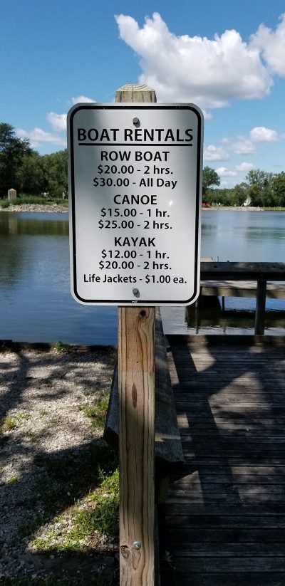
141.5. Village Hall Park
Waterford, Racine County
River mile 141.54 West bank, 42.7639° -88.2131°
View on map | Get directions |
Back to topRiver mile 141.54 West bank, 42.7639° -88.2131°
Access type: Carry-In
Fee? No
Signs: Water, Land
Vehicle Access: Street Parking
Owner: Village
Amenities: Restroom, Drinking Water, Shelter, Picnicking, Fishing, Onsite Boat Rental, Concert Events, Outfitter
Notes: Concrete launch
141.5. River Bend Park
Waterford, Racine County
River mile 141.46 West bank, 42.7629° -88.2136°
View on map | Get directions |
Back to topRiver mile 141.46 West bank, 42.7629° -88.2136°
Access type: Carry-In
Fee? No
Signs: Water, Land
Vehicle Access: Street Parking
Owner: Village
Amenities: none
Notes: Gradual grassy slope to river
141.4. 10 Club Park (Temporarily Closed)
Waterford, Racine County
River mile 141.4 East bank, 42.762° -88.2136°
View on map | Get directions |
Back to topRiver mile 141.4 East bank, 42.762° -88.2136°
Access type: To be developed
Fee? No
Signs: Water, Land
Vehicle Access: Parking Lot
Owner:
Amenities: Restroom, Drinking Water, Shelter, Picnicking
Notes: TEMPORARILY CLOSED FOR IMPROVEMENTS. This site will be closed in 2023 due to construction and anticipated to be open in 2024.
139.7. Pioneer Memorial Park
Rochester, Racine County
River mile 139.67 West bank, 42.7402° -88.2248°
View on map | Get directions |
Back to topRiver mile 139.67 West bank, 42.7402° -88.2248°
Access type: Carry-In
Fee? No
Signs: Water, Land
Vehicle Access: Roadside Parking
Owner: Village
Amenities: Restroom, Picnicking
Notes: Gradual grassy slope to river
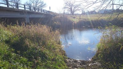
139.4. Case Eagle Park North
Rochester, Racine County
River mile 139.37 East bank, 42.7356° -88.2255°
View on map | Get directions |
Back to topRiver mile 139.37 East bank, 42.7356° -88.2255°
Access type: Carry-In
Fee? No
Signs: Water, Land
Vehicle Access: Parking Lot
Owner: County
Amenities: Restroom, Drinking Water, Shelter, Picnicking, Fishing, Hiking, Biking, Bird Watching, Natural Area
Notes: North of dam access, shelter and seasonal restroom and drinking water about one-quarter mile away in park
139.3. Case Eagle Park South
Rochester, Racine County
River mile 139.32 East bank, 42.7354° -88.2257°
View on map | Get directions |
Back to topRiver mile 139.32 East bank, 42.7354° -88.2257°
Access type: Carry-In
Fee? No
Signs: Water, Land
Vehicle Access: Parking Lot
Owner: County
Amenities: Restroom, Drinking Water, Shelter, Picnicking, Fishing, Hiking, Biking, Bird Watching, Natural Area
Notes: South of dam access, shelter and seasonal restroom and drinking water about one-quarter mile away in park
138.1. Saller Woods
Rochester, Racine County
River mile 138.14 West bank, 42.7233° -88.2235°
View on map | Get directions |
Back to topRiver mile 138.14 West bank, 42.7233° -88.2235°
Access type: Carry-In
Fee? No
Signs: Water, Land
Vehicle Access: Parking Lot
Owner: County
Amenities: Hiking, Biking, Bird Watching, Natural Area
Notes: Gradual grassy slope to river
136.2. CTH W Access Site
Burlington, Racine County
River mile 136.21 West bank, 42.7043° -88.2387°
View on map | Get directions |
Back to topRiver mile 136.21 West bank, 42.7043° -88.2387°
Access type: Carry-In
Fee? No
Signs: Water, Land
Vehicle Access: Roadside Parking
Owner: County ROW
Amenities: none
Notes: Gradual grassy slope to river.
133.7. Riverside Park
Burlington, Racine County
River mile 133.67 West bank, 42.6818° -88.2678°
View on map | Get directions |
Back to topRiver mile 133.67 West bank, 42.6818° -88.2678°
Access type: Developed
Fee? No
Signs: Water, Land
Vehicle Access: Parking Lot
Owner: City
Amenities: Restroom, Shelter, Bird Watching, Natural Area
Notes: Best suited for carry-in access due to steep drop from pavement to river.
133.3. Wehmhoff-Jucker Park
Burlington, Racine County
River mile 133.33 East bank, 42.681° -88.2725°
View on map | Get directions |
Back to topRiver mile 133.33 East bank, 42.681° -88.2725°
Access type: Carry-In
Fee? No
Signs: Water, Land
Vehicle Access: Parking Lot
Owner:
Amenities: Restroom, Picnicking
Notes:
132.6. Bushnell Park
Burlington, Racine County
River mile 132.55 East bank, 42.6714° -88.2646°
View on map | Get directions |
Back to topRiver mile 132.55 East bank, 42.6714° -88.2646°
Access type: Carry-In
Fee? No
Signs: Water, Land
Vehicle Access: Parking Lot
Owner: County
Amenities: Restroom, Shelter, Hiking, Bird Watching, Natural Area
Notes: Paved trail to river from parking lot.
132.4. St. Mary's Park
Burlington, Racine County
River mile 132.39 West bank, 42.669° -88.2652°
View on map | Get directions |
Back to topRiver mile 132.39 West bank, 42.669° -88.2652°
Access type: Carry-In
Fee? No
Signs: Water, Land
Vehicle Access: Parking Lot
Owner: City
Amenities: Restroom
Notes: Launch area adjacent to dog park.
127.8. Hoosier Creek Road Access Site
Burlington, Racine County
River mile 127.76 East bank, 42.6184° -88.2229°
View on map | Get directions |
Back to topRiver mile 127.76 East bank, 42.6184° -88.2229°
Access type: Carry-In
Fee? No
Signs: Water, Land
Vehicle Access: Parking Area
Owner: Town
Amenities: Bird Watching, Natural Area
Notes: Launch area is at end of road.
127.2. CTH JB Access
Wheatland, Kenosha County
River mile 127.22 East bank, 42.611° -88.225°
View on map | Get directions |
Back to topRiver mile 127.22 East bank, 42.611° -88.225°
Access type: Carry-In
Fee? No
Signs: Water, Land
Vehicle Access: Roadside Parking
Owner: County ROW
Amenities: Picnicking, Bird Watching, Natural Area
Notes: Access on southeast corner of bridge, gravel launch
124.3. 328th Avenue / CTH W
New Munster, Kenosha County
River mile 124.33 East bank, 42.578° -88.2039°
View on map | Get directions |
Back to topRiver mile 124.33 East bank, 42.578° -88.2039°
Access type: Carry-In
Fee? No
Signs: Water, Land
Vehicle Access: Parking Area
Owner: County ROW
Amenities: Picnicking, Fishing, Bird Watching, Natural Area
Notes: Concrete steps carry-in launch
118.6. Fox River Park Access
Silver Lake, Kenosha County
River mile 118.63 West bank, 42.5409° -88.1706°
View on map | Get directions |
Back to topRiver mile 118.63 West bank, 42.5409° -88.1706°
Access type: Developed
Fee? No
Signs: Water, Land
Vehicle Access: Parking Lot
Owner: County
Amenities: Restroom, Drinking Water, Shelter, Picnicking, Bird Watching, Natural Area
Notes: Concrete plank launch; shelter and seasonal restroom and drinking water about one-quarter mile away in park
116.1. Wilmot Access (CTH C)
Wilmot, Kenosha County
River mile 116.12 East bank, 42.5105° -88.1801°
View on map | Get directions |
Back to topRiver mile 116.12 East bank, 42.5105° -88.1801°
Access type: Carry-In
Fee? No
Signs: Water, Land
Vehicle Access: Parking Area
Owner: County
Amenities: Restroom, Drinking Water, Picnicking, Fishing, Bird Watching, Natural Area
Notes: Access on east side of river, south side of CTH C
113.5. Oak Point in Chain O' Lakes SP
Lake County
River mile 113.45 East bank, 42.4772° -88.1755°
View on map | Get directions |
Back to topRiver mile 113.45 East bank, 42.4772° -88.1755°
Access type: Carry-In
Fee? Yes
Signs: Water, Land
Vehicle Access: Parking Lot
Owner: State
Amenities: Restroom, Drinking Water (Seasonal), Fishing, Hiking, Biking, Bird Watching, Natural Area
Notes: Shelter, Picknicking & Camping available further into the State Park. Trips of any length between the Illinois State line to the Algonquin Dam require a sticker from the Fox Waterway Agency.
110.6. Maple Grove Launch in Chain O'Lakes SP
Lake County
River mile 110.57 West bank, 42.4472° -88.1817°
View on map | Get directions |
Back to topRiver mile 110.57 West bank, 42.4472° -88.1817°
Access type: Carry-In
Fee? Yes
Signs: Water, Land
Vehicle Access: Parking Lot
Owner: State
Amenities: Restroom, Drinking Water (Seasonal), Shelter, Picnicking, Fishing, Hiking, Biking, Bird Watching, Natural Area, Onsite Boat Rental, Restaurant (Carryout)
Notes: Camping available at other locations in the State Park. Trips of any length between the Illinois State line to the Algonquin Dam require a sticker from the Fox Waterway Agency.
100.7. Miller Point
McHenry, McHenry County
River mile 100.74 West bank, 42.3432° -88.2627°
View on map | Get directions |
Back to topRiver mile 100.74 West bank, 42.3432° -88.2627°
Access type: Carry-In
Fee? Yes
Signs: Water, Land
Vehicle Access: Parking Lot
Owner: City
Amenities: Restroom (seasonal), Drinking Water, Picnicking, Fishing, Hiking
Notes: Part of the developing Riverwalk. Boat rentals, food and restrooms are provided seasonally by All Marine’s Retro Rentals and Beach Bar. The sand launch is intended to resemble a beach. Trips of any length between the Illinois State line to the Algonquin Dam require a sticker from the Fox Waterway Agency.
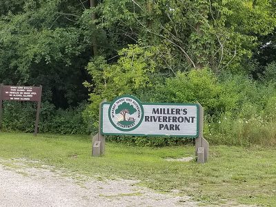
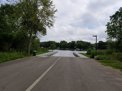
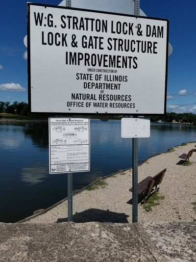
99.4. Miller's Riverfront Park and Boat Launch
McHenry, McHenry County
River mile 99.42 West bank, 42.3273° -88.2535°
View on map | Get directions |
Back to topRiver mile 99.42 West bank, 42.3273° -88.2535°
Access type: Carry-In
Fee? Yes
Signs: Water, Land
Vehicle Access: Parking Lot
Owner: City
Amenities: Shelter, Picnicking, Fishing, Hiking
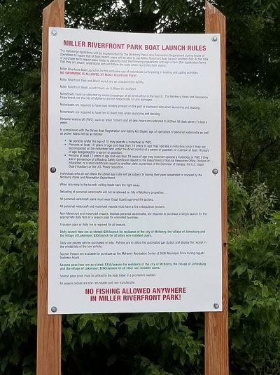
Notes: Turn onto Conservation Dr. Previously, only motorized craft were allowed. Currently, non-motorized boats are now allowed. Fees: daily resident $25, non-resident $30, yearly resident $150, non-resident $180. Trips of any length between the Illinois State line to the Algonquin Dam require a sticker from the Fox Waterway Agency.
98.2. Moraine Hills State Park (above dam)
McHenry, McHenry County
River mile 98.2 East bank, 42.3101° -88.25°
View on map | Get directions |
Back to topRiver mile 98.2 East bank, 42.3101° -88.25°
Access type: Carry-In
Fee? Yes
Signs: Water, Land
Vehicle Access: Parking Lot
Owner: State
Amenities: Restroom, Drinking Water, Shelter, Picnicking, Playground, Fishing, Hiking, Biking, Bird Watching, Natural Area, Onsite Boat Rental (seasonal), Restaurant (Carryout, seasonal)
Notes: Buoys exist above and below dam. Access sites above and below dam have been improved with signage since previous visit in Fall, 2017. Trips of any length between the Illinois State line to the Algonquin Dam require a sticker from the Fox Waterway Agency.
98.1. Moraine Hills State Park (below dam)
McHenry, McHenry County
River mile 98.09 East bank, 42.3086° -88.2502°
View on map | Get directions |
Back to topRiver mile 98.09 East bank, 42.3086° -88.2502°
Access type: Carry-In
Fee? Yes
Signs: Water, Land
Vehicle Access: Parking Lot
Owner: State
Amenities: Restroom, Drinking Water, Shelter, Picnicking, Playground, Fishing, Hiking, Biking, Bird Watching, Natural Area, Onsite Boat Rental (seasonal), Restaurant (Carryout, seasonal)
Notes: Trips of any length between the Illinois State line to the Algonquin Dam require a sticker from the Fox Waterway Agency.
92.3. Hickory Grove Riverfront
Cary, McHenry County
River mile 92.33 West bank, 42.2376° -88.2091°
View on map | Get directions |
Back to topRiver mile 92.33 West bank, 42.2376° -88.2091°
Access type: Carry-In
Fee? Yes
Signs: Water, Land
Vehicle Access: Parking Lot
Owner: McHenry County Conservation District
Amenities: Restroom, Drinking Water, Shelter, Camping, Picnicking, Fishing, Hiking, Bird Watching, Natural Area
Notes: Trips of any length between the Illinois State line to the Algonquin Dam require a sticker from the Fox Waterway Agency.
91.2. Fox River Forest Preserve
Port Barrington, Lake County
River mile 91.17 East bank, 42.2387° -88.1866°
View on map | Get directions |
Back to topRiver mile 91.17 East bank, 42.2387° -88.1866°
Access type: Carry-In
Fee? Yes
Signs: Water, Land
Vehicle Access: Parking Lot
Owner: County
Amenities: Restroom, Drinking Water, Shelter, Camping, Picnicking, Fishing, Hiking, Biking, Bird Watching, Natural Area, Marina
Notes: Youth camping available. Trips of any length between the Illinois State line to the Algonquin Dam require a sticker from the Fox Waterway Agency.
84.4. Fox Bluff Conservation Area
Cary, McHenry County
River mile 84.35 West bank, 42.1914° -88.2596°
View on map | Get directions |
Back to topRiver mile 84.35 West bank, 42.1914° -88.2596°
Access type: Carry-In
Fee? Yes
Signs: Water, Land
Vehicle Access: Parking Lot
Owner: McHenry County Conservation District
Amenities: Restroom, Drinking Water, Shelter, Picnicking, Fishing, Hiking, Bird Watching, Natural Area
Notes: Trips of any length between the Illinois State line to the Algonquin Dam require a sticker from the Fox Waterway Agency.
82.1. Riverfront Park
Algonquin, McHenry County
River mile 82.05 West bank, 42.1686° -88.2884°
View on map | Get directions |
Back to topRiver mile 82.05 West bank, 42.1686° -88.2884°
Access type: Carry-In
Fee? Yes
Signs: Water, Land
Vehicle Access: Parking Lot
Owner: City
Amenities: Shelter, Picnicking, Restaurant (Next door)
Notes: Restaurant next door, concerts with food trucks. Trips of any length between the Illinois State line to the Algonquin Dam require a sticker from the Fox Waterway Agency.
81.8. Cornish Park (below dam)
Algonquin, McHenry County
River mile 81.82 West bank, 42.1657° -88.2907°
View on map | Get directions |
Back to topRiver mile 81.82 West bank, 42.1657° -88.2907°
Access type: Carry-In
Fee? No
Signs: Water, Land
Vehicle Access: Parking Lot
Owner: City
Amenities: Restroom, Drinking Water, Shelter, Picnicking, Playground, Fishing, Concert Events
Notes:
80.6. Buffalo Park Forest Preserve
Algonquin, Kane County
River mile 80.55 West bank, 42.1487° -88.2929°
View on map | Get directions |
Back to topRiver mile 80.55 West bank, 42.1487° -88.2929°
Access type: Carry-In
Fee? No
Signs: Water, Land
Vehicle Access: Parking Lot
Owner: Forest Preserve District
Amenities: Restroom, Picnicking, Fishing, Bird Watching, Natural Area
Notes:
78.3. Fox River Shores Forest Preserve
Carpentersville, Kane County
River mile 78.33 East bank, 42.1254° -88.2846°
View on map | Get directions |
Back to topRiver mile 78.33 East bank, 42.1254° -88.2846°
Access type: Carry-In
Fee? No
Signs: Water, Land
Vehicle Access: Parking Lot
Owner: Forest Preserve District
Amenities: Restroom, Drinking Water, Shelter, Picnicking, Fishing, Hiking, Biking, Bird Watching, Natural Area
Notes: Access to the Fox River Bike Trail. Across the River from Brunner Forest Preserve with no access site.
76.7. McNamee Park
Carpentersville, Kane County
River mile 76.67 East bank, 42.1051° -88.2857°
View on map | Get directions |
Back to topRiver mile 76.67 East bank, 42.1051° -88.2857°
Access type: Carry-In
Fee? No
Signs: Water, Land
Vehicle Access: Parking Lot
Owner: Village
Amenities: Shelter, Picnicking
Notes:
75.9. Downtown West Dundee
West Dundee, Kane County
River mile 75.91 West bank, 42.0971° -88.2763°
View on map | Get directions |
Back to topRiver mile 75.91 West bank, 42.0971° -88.2763°
Access type: Carry-In
Fee? No
Signs: Water, Land
Vehicle Access: Parking Lot
Owner: Village
Amenities: Fishing, Hiking
Notes: Part of the Village’s Riverwalk located in the downtown.
75.2. South End Park
West Dundee, Kane County
River mile 75.2 West bank, 42.0881° -88.2769°
View on map | Get directions |
Back to topRiver mile 75.2 West bank, 42.0881° -88.2769°
Access type: Carry-In
Fee? No
Signs: Water, Land
Vehicle Access: None
Owner: Village
Amenities: Restroom, Shelter, Picnicking, Playground, Biking
Notes: Parking not allowed near launch.
73.6. Voyageur Landing Forest Preserve (North)
Elgin, Kane County
River mile 73.63 West bank, 42.0693° -88.2721°
View on map | Get directions |
Back to topRiver mile 73.63 West bank, 42.0693° -88.2721°
Access type: Carry-In
Fee? No
Signs: Water, Land
Vehicle Access: Parking Lot
Owner: Forest Preserve District
Amenities: Restroom, Shelter, Picnicking, Fishing, Hiking, Biking, Bird Watching, Natural Area
Notes: Long site with 2 accesses; this one is north of the entrance.
73.5. Voyageur Landing Forest Preserve (South)
Elgin, Kane County
River mile 73.51 West bank, 42.0678° -88.2723°
View on map | Get directions |
Back to topRiver mile 73.51 West bank, 42.0678° -88.2723°
Access type: Carry-In
Fee? No
Signs: Water, Land
Vehicle Access: Parking Lot
Owner: Forest Preserve District
Amenities: Restroom, Shelter, Picnicking, Fishing, Bird Watching, Natural Area
Notes: Long site with 2 accesses; this one is near the entrance.
73.3. Trout Park
Elgin, Kane County
River mile 73.3 East bank, 42.0646° -88.2714°
View on map | Get directions |
Back to topRiver mile 73.3 East bank, 42.0646° -88.2714°
Access type: Carry-In
Fee? No
Signs: Water, Land
Vehicle Access: Parking Lot
Owner: City
Amenities: Restroom, Shelter, Picnicking, Playground, Fishing, Hiking, Biking, Bird Watching, Natural Area
Notes: Ladder for accessibility.
72.1. Slade Avenue Park
Elgin, Kane County
River mile 72.11 East bank, 42.0539° -88.2892°
View on map | Get directions |
Back to topRiver mile 72.11 East bank, 42.0539° -88.2892°
Access type: Carry-In
Fee? No
Signs: Water, Land
Vehicle Access: Parking Lot
Owner: City
Amenities: Fishing, Hiking, Biking
Notes:
71.4. Veterans Memorial Park
Elgin, Kane County
River mile 71.35 East bank, 42.0438° -88.289°
View on map | Get directions |
Back to topRiver mile 71.35 East bank, 42.0438° -88.289°
Access type: Carry-In
Fee? No
Signs: Water, Land
Vehicle Access: Parking Lot
Owner: City
Amenities: Biking
Notes:
71.1. Kimball Street Dam
Elgin, Kane County
River mile 71.12 East bank, 42.0406° -88.2882°
View on map | Get directions |
Back to topRiver mile 71.12 East bank, 42.0406° -88.2882°
Access type: Carry-In
Fee? No
Signs: Water, Land
Vehicle Access: Parking Lot
Owner: City
Amenities: Shelter, Fishing, Hiking, Biking
Notes:
69.3. Elgin Shores Forest Preserve
Elgin, Kane County
River mile 69.34 West bank, 42.018° -88.2781°
View on map | Get directions |
Back to topRiver mile 69.34 West bank, 42.018° -88.2781°
Access type: Carry-In
Fee? No
Signs: Water, Land
Vehicle Access: Parking Lot
Owner: Forest Preserve District
Amenities: Restroom, Shelter, Fishing, Hiking, Biking, Bird Watching, Natural Area
Notes: Bike trail system located on east side of river.
65.4. Jon J. Duerr Forest Preserve
South Elgin, Kane County
River mile 65.44 West bank, 41.9697° -88.3005°
View on map | Get directions |
Back to topRiver mile 65.44 West bank, 41.9697° -88.3005°
Access type: Carry-In
Fee? No
Signs: Water, Land
Vehicle Access: Parking Lot
Owner: Forest Preserve District
Amenities: Restroom, Drinking Water, Shelter, Picnicking, Fishing, Hiking, Biking, Bird Watching, Natural Area
Notes:
61. Ferson Creek Park
St. Charles, Kane County
River mile 61.01 West bank, 41.9272° -88.3187°
View on map | Get directions |
Back to topRiver mile 61.01 West bank, 41.9272° -88.3187°
Access type: Carry-In
Fee? No
Signs: Water, Land
Vehicle Access: Parking Lot
Owner: St. Charles Park District
Amenities: Restroom, Drinking Water, Shelter, Picnicking, Playground, Fishing, Hiking, Bird Watching
Notes: Park open dawn and dusk. Seasonable rentable boat storage racks available.
60.5. Boy Scout Island
St. Charles, Kane County
River mile 60.5 West bank, 41.9202° -88.3185°
View on map | Get directions |
Back to topRiver mile 60.5 West bank, 41.9202° -88.3185°
Access type: Developed
Fee? Yes
Signs: Water, Land
Vehicle Access: Parking Lot
Owner: St. Charles Park District
Amenities: Restroom (Seasonal), Drinking Water, Shelter, Picnicking, Fishing, Bird Watching
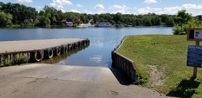
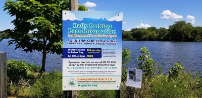
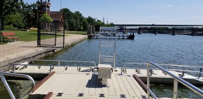
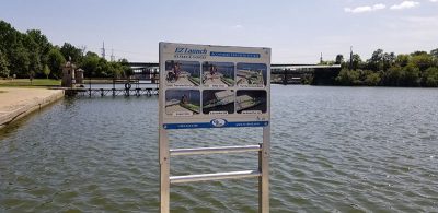
Notes: Both the concrete ramp and nearby sandy shoreline are available to paddlers. Park open dawn to 11pm. $10 daily parking Memorial Day to Labor Day. Access site closed for the season after the first snowfall and opened in the spring when conditions are favorable.
60.4. Pottawatomie Park
St. Charles, Kane County
River mile 60.36 East bank, 41.9189° -88.3158°
View on map | Get directions |
Back to topRiver mile 60.36 East bank, 41.9189° -88.3158°
Access type: Accessible seasonal dock
Fee? No
Signs: Water, Land
Vehicle Access: Parking Lot
Owner: St. Charles Park District
Amenities: Restroom, Picnicking, Playground (Inclusive with sensory garden), Swimming (Outdoor Pool), Fishing, Biking (Plaza with Repair Station), Bird Watching, Natural Area (Native plant garden), Restaurant (Seasonal refreshment stand), Paddlewheel Riverboats, Golf Course, Miniature Golf Course, Outdoor Fitness Stations, Softball, Tennis, Sand Volleyball
Notes: Accessible for people with disabilities. Bike plaza has access to Fox River Trail. Park open dawn to 11pm.
60.2. Frank Gorham Memorial Canoe Launch
St. Charles, Kane County
River mile 60.16 East bank, 41.916° -88.3145°
View on map | Get directions |
Back to topRiver mile 60.16 East bank, 41.916° -88.3145°
Access type: Carry-in seasonal
Fee? No
Signs: Water, Land
Vehicle Access: Parking Lot
Owner: City
Amenities: Fishing, Hiking, Biking
Notes: Seasonal dock
59.5. Mt. St. Mary Park
St. Charles, Kane County
River mile 59.49 West bank, 41.9077° -88.3083°
View on map | Get directions |
Back to topRiver mile 59.49 West bank, 41.9077° -88.3083°
Access type: Carry-In
Fee? No
Signs: Water, Land
Vehicle Access: Parking Lot
Owner: St. Charles Park District
Amenities: Restroom, Drinking Water, Shelter, Picnicking, Playground, Fishing, Hiking, Biking, Bird Watching, Natural Area (Outdoor Arboretum), Exhibits (Sculpture in the Park)
Notes: Park open dawn to dusk. Access to Fox River Trail.
58.3. Geneva Boat Launch
Geneva, Kane County
River mile 58.29 West bank, 41.8918° -88.3026°
View on map | Get directions |
Back to topRiver mile 58.29 West bank, 41.8918° -88.3026°
Access type: Carry-In
Fee? Yes
Signs: Water, Land
Vehicle Access: Street Parking and Lot
Owner: City
Amenities: none
Notes: Need to purchase a permit to use ramp: $20 residents, $40 non-residents, $5 seniors One purchase per season April through October, purchase at police dept., 20 Police Plaza.
56.5. Fabyan Forest Preserve
Geneva, Kane County
River mile 56.47 West bank, 41.8666° -88.3114°
View on map | Get directions |
Back to topRiver mile 56.47 West bank, 41.8666° -88.3114°
Access type: Carry-In
Fee? No
Signs: Water, Land
Vehicle Access: Parking Lot
Owner: Forest Preserve District
Amenities: Restroom, Drinking Water, Shelter, Picnicking, Fishing, Hiking, Biking, Bird Watching, Natural Area
Notes:
55.9. Laurelwood Park
Batavia, Kane County
River mile 55.92 East bank, 41.8589° -88.309°
View on map | Get directions |
Back to topRiver mile 55.92 East bank, 41.8589° -88.309°
Access type: Carry-In
Fee? No
Signs: Water, Land
Vehicle Access: Parking Lot
Owner: Batavia Park District
Amenities: Restroom, Shelter, Picnicking, Fishing, Hiking, Biking, Bird Watching, Natural Area
Notes:
55.7. Batavia Dam (above dam)
Batavia, Kane County
River mile 55.67 Middle, 41.855° -88.3097°
View on map | Get directions |
Back to topRiver mile 55.67 Middle, 41.855° -88.3097°
Access type: Carry-In
Fee? No
Signs: Water, Land
Vehicle Access: None
Owner: Batavia Park District
Amenities: Restroom, Shelter, Picnicking, Playground, Fishing, Hiking, Bird Watching, Natural Area
Notes: Restroom at Police Station. Portage. Exit from river above dam is not paved. Portage newly signed.
55.6. Batavia Dam (below dam)
Batavia, Kane County
River mile 55.63 Middle, 41.8546° -88.3084°
View on map | Get directions |
Back to topRiver mile 55.63 Middle, 41.8546° -88.3084°
Access type: Carry-In
Fee? No
Signs: Water, Land
Vehicle Access: None
Owner: Batavia Park District
Amenities: Restroom, Shelter, Picnicking, Playground, Fishing, Hiking, Bird Watching, Natural Area
Notes: Restroom at Police Station. Portage. Entrance to river below dam is paved. Portage newly signed.
55.5. Batavia Riverwalk Ramp
Batavia, Kane County
River mile 55.47 Middle, 41.8524° -88.3094°
View on map | Get directions |
Back to topRiver mile 55.47 Middle, 41.8524° -88.3094°
Access type: Carry-In
Fee? No
Signs: Water, Land
Vehicle Access: Parking Lot
Owner: Batavia Park District
Amenities: Restroom, Shelter
Notes: Ramp next to paddleboat dock.
49.3. Veterans Memorial Island Park
Aurora, Kane County
River mile 49.33 East bank, 41.7699° -88.309°
View on map | Get directions |
Back to topRiver mile 49.33 East bank, 41.7699° -88.309°
Access type: Carry-In
Fee? No
Signs: Water, Land
Vehicle Access: Parking Lot
Owner: Park District
Amenities: none
Notes:
48.4. Aurora (West)
Aurora, Kane County
River mile 48.44 West bank, 41.7584° -88.3159°
View on map | Get directions |
Back to topRiver mile 48.44 West bank, 41.7584° -88.3159°
Access type: Carry-In
Fee? No
Signs: Water, Land
Vehicle Access: Parking Lot
Owner: City
Amenities: Hiking, Biking
Notes: Parking at Waubonsee Community College
47.1. South River Street Park
Aurora, Kane County
River mile 47.1 West bank, 41.7427° -88.3296°
View on map | Get directions |
Back to topRiver mile 47.1 West bank, 41.7427° -88.3296°
Access type: Carry-In
Fee? No
Signs: Water, Land
Vehicle Access: Parking Lot
Owner: Park District
Amenities: Shelter, Picnicking, Biking
Notes: Accessible launch for individuals with disabilities.
43.9. Violet Patch Park
Oswego, Kendall County
River mile 43.87 East bank, 41.7009° -88.3497°
View on map | Get directions |
Back to topRiver mile 43.87 East bank, 41.7009° -88.3497°
Access type: Carry-In
Fee? No
Signs: Water, Land
Vehicle Access: Parking Lot
Owner: Park District
Amenities: Restroom, Drinking Water, Shelter, Camping, Picnicking, Fishing, Hiking, Biking, Bird Watching, Natural Area
Notes:
42.7. Hudson Crossing Park
Oswego, Kendall County
River mile 42.7 East bank, 41.6855° -88.3555°
View on map | Get directions |
Back to topRiver mile 42.7 East bank, 41.6855° -88.3555°
Access type: Carry-In
Fee? No
Signs: Water, Land
Vehicle Access: Parking Lot
Owner: Park District
Amenities: Restroom, Drinking Water, Shelter, Picnicking, Fishing, Hiking, Biking, Bird Watching, Concert Events
Notes:
40.4. Saw-Wee-Kee Park
Oswego, Kendall County
River mile 40.36 East bank, 41.6728° -88.3948°
View on map | Get directions |
Back to topRiver mile 40.36 East bank, 41.6728° -88.3948°
Access type: Developed Motorized Launch
Fee? No
Signs: Water, Land
Vehicle Access: Parking Lot
Owner: Park District
Amenities: Shelter, Picnicking, Fishing, Hiking, Biking, Bird Watching, Natural Area
Notes:
36.3. Marge Cline Whitewater Course
Yorkville, Kendall County
River mile 36.34 South bank, 41.6425° -88.4408°
View on map | Get directions |
Back to topRiver mile 36.34 South bank, 41.6425° -88.4408°
Access type: Carry-In
Fee? No
Signs: Water, Land
Vehicle Access: Parking Lot
Owner: City
Amenities: Restroom, Drinking Water, Shelter, Picnicking, Playground, Fishing, Bird Watching, Natural Area, Restaurant
Notes: Marge Cline Whitewater Course exists on south half of river. Dam exists on north half of river. Accessible for people with disabilities.
31.7. Silver Springs State Park
Yorkville, Kendall County
River mile 31.67 South bank, 41.6334° -88.5267°
View on map | Get directions |
Back to topRiver mile 31.67 South bank, 41.6334° -88.5267°
Access type: Carry-In
Fee? No
Signs: Water, Land
Vehicle Access: Parking Lot
Owner: State
Amenities: Restroom, Drinking Water, Shelter, Camping, Picnicking, Playground, Fishing, Hiking, Bird Watching, Natural Area
Notes: Closed in Winter
28.9. Shuh Shuh Gah Forest Preserve
Newark, Kendall County
River mile 28.89 West bank, 41.6092° -88.5629°
View on map | Get directions |
Back to topRiver mile 28.89 West bank, 41.6092° -88.5629°
Access type: Carry-In
Fee? No
Signs: Water, Land
Vehicle Access: Parking Lot
Owner: Kendall County Forest Preserve District
Amenities: Restroom, Shelter, Picnicking, Fishing, Hiking, Biking, Bird Watching, Natural Area
Notes: At time of visit accessible launch appeared to be damaged from flooding. Gates are closed and locked at sunset.
24.8. Lois Landing
Millington, LaSalle County
River mile 24.83 West bank, 41.5634° -88.6063°
View on map | Get directions |
Back to topRiver mile 24.83 West bank, 41.5634° -88.6063°
Access type: Carry-In
Fee? No
Signs: Water, Land
Vehicle Access: Parking Lot
Owner: Village
Amenities: none
Notes:
5.7. Dayton Dam (above dam)
Dayton, LaSalle County
River mile 5.72 West bank, 41.3916° -88.7882°
View on map | Get directions |
Back to topRiver mile 5.72 West bank, 41.3916° -88.7882°
Access type: Carry-In
Fee? No
Signs: Water, Land
Vehicle Access: Parking Lot
Owner: Eagle Creek Renewable Energy
Amenities: Picnicking, Fishing, Bird Watching, Natural Area
Notes: Access above dam.
5.4. Dayton Dam (below dam)
Dayton, LaSalle County
River mile 5.44 West bank, 41.3879° -88.7894°
View on map | Get directions |
Back to topRiver mile 5.44 West bank, 41.3879° -88.7894°
Access type: Carry-In
Fee? No
Signs: Water, Land
Vehicle Access: Parking Lot
Owner: Eagle Creek Renewable Energy
Amenities: Camping, Picnicking, Fishing, Bird Watching, Natural Area
Notes: Access below dam.
0.8. Fox River Park
Ottawa, LaSalle County
River mile 0.77 North bank, 41.3497° -88.8323°
View on map | Get directions |
Back to topRiver mile 0.77 North bank, 41.3497° -88.8323°
Access type: Carry-In
Fee? No
Signs: Water, Land
Vehicle Access: Parking Lot
Owner: City
Amenities: Restroom, Drinking Water, Shelter, Picnicking, Playground, Fishing, Hiking, Biking, Bird Watching, Natural Area, Marina
Notes: Signage faded.